


BILLINGS — A strong weather system is moving through the region, bringing widespread precipitation that will shift from west to east of Billings over the next few days. Areas west of Billings face flooding concerns due to heavy rainfall, while mountain areas may see snow.
There is a marginal risk for excessive rainfall west of Billings, where areas have already received over an inch of rain in 24 hours and could see another 0.5 inches.
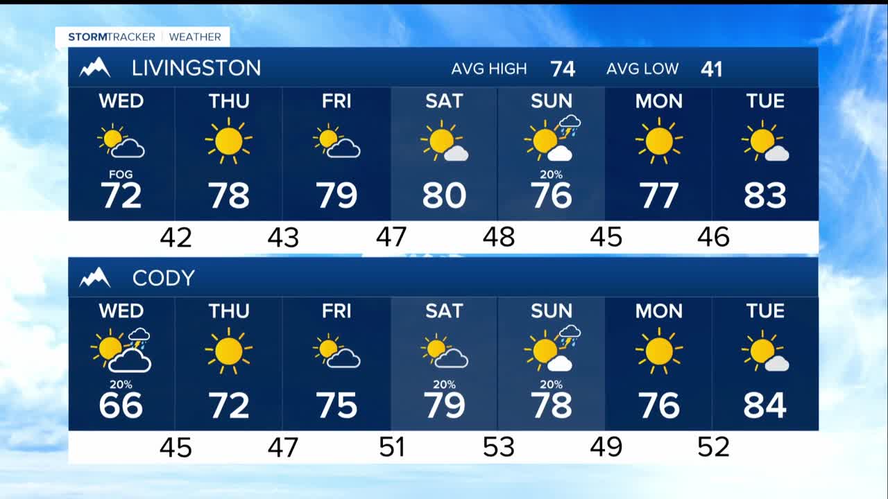
The active pattern continues through the weekend with generally cooler temperatures in the 70s before warming returns. Highs by the weekend and early next week will reach the 70s to mid-80s.
Tonight: Precipitation shifts from west of Billings to areas east of the city. Mountain snow becomes less likely on the Beartooth Highway as conditions change.
Wednesday-Thursday: A new low pressure system develops over the Central Plains, bringing 30-60% chances of showers and thunderstorms to areas south and east of the Red Lodge to Baker line. Carter County has the highest chances for significant rainfall.
Friday-Monday: Multiple weather systems will pass close by with minimal impacts. Models suggest upper-level ridging may return next week.
