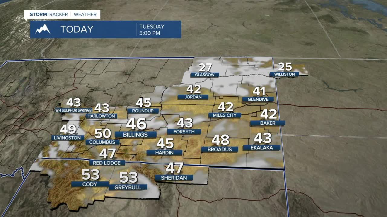


BILLINGS — Patchy freezing fog is expected Tuesday morning roughly along and east of a line from Harlowton to Billings to Sheridan, especially in low-lying areas and river valleys. Visibility may drop quickly in spots, and slick roads are possible, so slow down and use caution.
The rest of the week aims to be rather quiet heading into the Christmas holiday, as a broad upper ridge settles over the central U.S. through Wednesday, keeping conditions mainly dry with above-normal temperatures. Highs will generally reach the 40s to mid-50s.
Pressure gradients tighten in the Paradise Valley Tuesday night into Wednesday, which could lead to some gusty gap winds near Livingston and Nye, with gusts over 50 mph possible.
By Wednesday night, Pacific moisture returns to the Absaroka and Beartooth ranges, bringing a chance of 3–6 inches of mountain snow along with a brief round of scattered rain and snow showers at lower elevations into Thursday. Highs on Thursday remain above normal, ranging from the 50s west to lower 40s east. Precipitation amounts stay light, with up to a tenth of an inch possible in some locations, especially along the foothills.
Moist southwest flow persists Thursday through Saturday, bringing a chance of over 6 inches of snow to the Beartooth and Absaroka mountains and areas north of Cooke City.
An upper-level trough moves across northern Montana Friday night into Saturday, bringing colder air and knocking daytime highs down into the 30s west and mid-20s east on Saturday, along with light snow showers at lower elevations.
Ridging rebuilds early next week, bringing a return to above-normal temperatures Sunday and Monday.
HOLIDAY TRAVEL
Travel across Montana and northern Wyoming through Christmas Day should be generally manageable. Mountain passes will see on-and-off snow, slick roads, and occasional reductions in visibility, while foothills and gap-flow areas may experience gusty winds at times, so plan for some impacts. Lower elevations should remain mostly dry, with only spotty light rain or snow and brief slick spots possible. Cooler air late in the week may bring a few light snow showers. Overall, travelers should allow extra time and stay alert for changing conditions—widespread shutdowns are not expected, but mountain travel will be the most challenging. Be sure to stay up-to-date on the latest travel conditions. Stay safe and Merry Christmas! 🎄🎄🎄
WY: https://map.wyoroad.info/511-map/
Miller Robson
Q2 Morning Meteorologist
miller.robson@ktvq.com
