


BILLINGS — Freezing rain will affect the Livingston area through about 9 AM Friday as warm downslope air overruns shallow surface cold air. Temperatures rise quickly this morning, bringing an end to the icing threat.
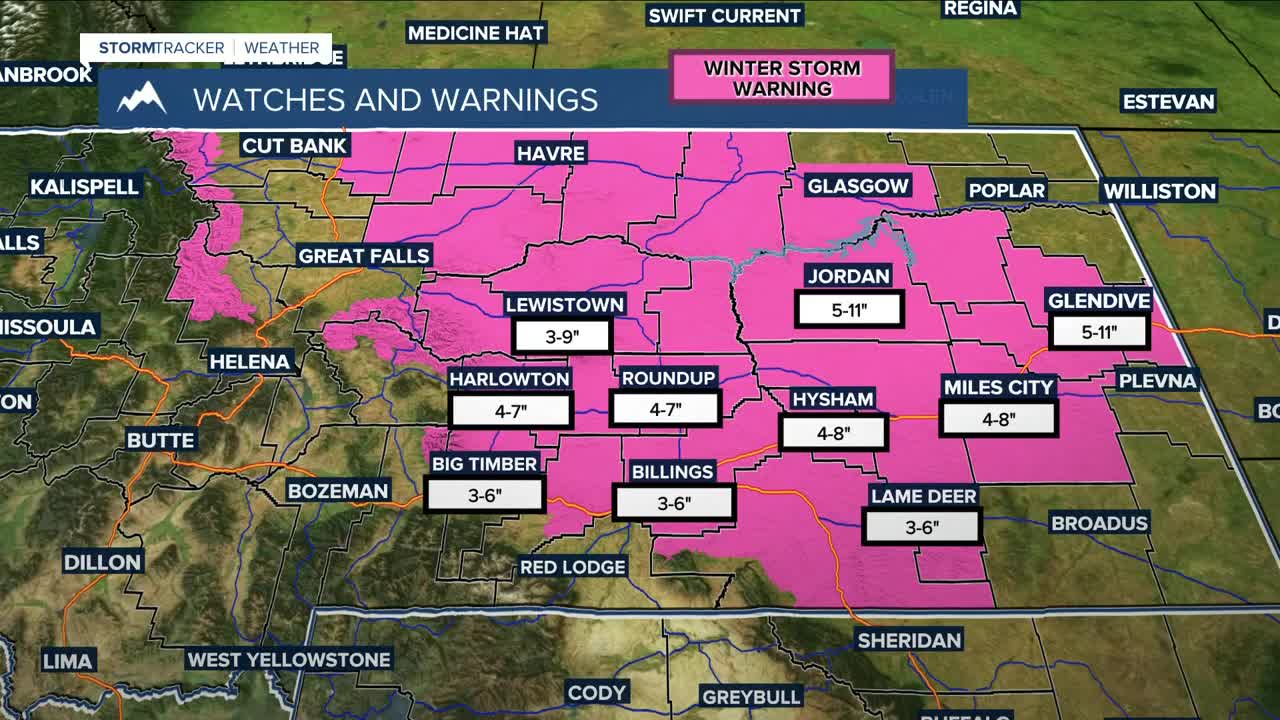
Heavy snow continues today, with the main band shifting north and east. This morning’s focus runs from Harlowton to Lodge Grass, then shifts this evening from Miles City to Ridgeway. Most lower elevations can expect 4–8 inches of additional snow, while 1–3 inches is more likely for Sheridan County WY, Powder River County, and southern Carter County MT. Northern Rosebud and Custer Counties have the best chance (40–60%) of reaching 6 inches or more. Lighter snow may drift back south and west late tonight into early Saturday, generally under an inch, before the system exits Saturday. Winter Storm Warnings and Winter Weather Advisories are in effect.
Winds increase Friday night along the western foothills and gap areas. Livingston could see gusts near 40–50 mph, with brief gusts around 40 mph along the US-191 corridor from Big Timber to Harlowton.
A warming trend arrives Sunday, with highs climbing back into the 40s under building ridging. Quiet, mild conditions hold through Sunday and Monday before a more active — and potentially windy — pattern develops midweek with clipper systems passing to the north.
Miller Robson
Q2 Morning Meteorologist
miller.robson@ktvq.com
