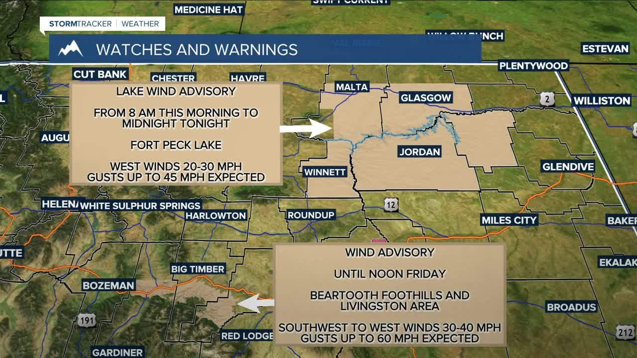


BILLINGS — The big weather story on Thursday will be the strong winds spreading across the area. Gusts of up to 55 mph will be possible along the US-191 corridor from Big Timber to Harlowton, and up to 60 mph along the I-90 corridor near Livingston, where a Wind Advisory is in effect through Friday noon. Gusts between 30–40 mph are possible elsewhere.
There will be some light rain showers in a few locations on Thursday. The Beartooths and Absarokas could pick up to 2 inches on west-facing slopes. The Bighorns could see some light snow, too.
A cold front will pass through from Friday into Saturday, bringing a slightly better chance of widespread light rain. The Beartooths and Absarokas could get at least a few more inches of snow above 7,500 feet. The Bighorns could see a few more inches as well. Light snow accumulation will also be possible over the foothills and higher elevations in the east. Keep an eye on road conditions if you plan to travel in those areas. Billings, Lockwood, Shepherd, and Worden may see a few flurries Saturday morning.
Winds will increase again Friday into Saturday, with gusts around 40–50 mph along the western foothills and between 30–40 mph across the rest of the area.
High pressure settles in late Saturday, bringing mostly dry conditions through next week.
Daytime highs will be in the mid-50s to low 60s through Friday, cooling mainly into the 40s and 50s over the weekend before warming back into the mid-50s to low 60s Monday and Tuesday.
Nighttime lows will be in the low to mid-30s Thursday and Friday nights, the low to mid-20s Saturday night, the mid-20s to low 30s Sunday night, then the upper 30s to mid-40s Monday night.
Miller Robson
Q2 Morning Meteorologist
miller.robson@ktvq.com
