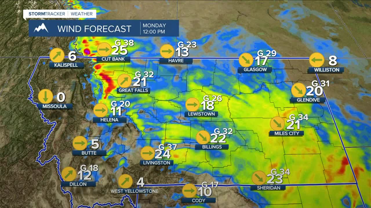


BILLINGS — The week begins on a windy note across the western foothills as a disturbance slides through, bringing gusts between 40–50 mph from Livingston to Nye through lunchtime. Gusts between 40–55 mph could also be felt from Big Timber to Harlowton through early afternoon. Gusts of 30–45 mph are possible across the plains.
Because of the breezy to gusty winds, low humidity between 20–35%, dry conditions, and warmer-than-average temperatures, there is an elevated risk for grass fires this week. Refrain from outside burning and activities that could cause a spark.
As the system moves toward the east, there will be a slight chance of snow (up to one inch) and freezing rain (light glaze) in areas closest to the Dakotas through Monday afternoon, so be wary of slick roads during that period.
Another weak disturbance is forecast to sweep through on Tuesday, bringing breezy winds across southern MT and northern WY, with gusts between 20–30 mph. This will also bring a slightly better chance of rain or rain/snow to the lower elevations, while area mountains could pick up light snow, especially W–NW-facing slopes.
Daytime highs are expected to range from the upper 40s to the low 60s this week, the warmest day being Thursday, when some locations could reach the mid-60s with a few records in jeopardy.
Nightly lows will be in the 20s and 30s.
Miller Robson
Q2 Morning Meteorologist
miller.robson@ktvq.com
