


BILLINGS — THROUGH TONIGHT: Gusts have reached up to 80 mph along the US-191 corridor from Big Timber to Harlowton, and the Livingston area into the Beartooth foothills. High Wind Warnings are in effect through this evening, with gusts up to 65 mph. Localized power outages are possible with winds this strong.
All five climate sites (Billings at 69°, Livingston reached 62°, Miles City hit an impressive 73°, Sheridan, WY and Baker made it to70°) have broken their daily record highs today. A strong surface high sweeps through northwest Montana this evening, bringing some welcome pressure rises and gradually easing winds by tonight.
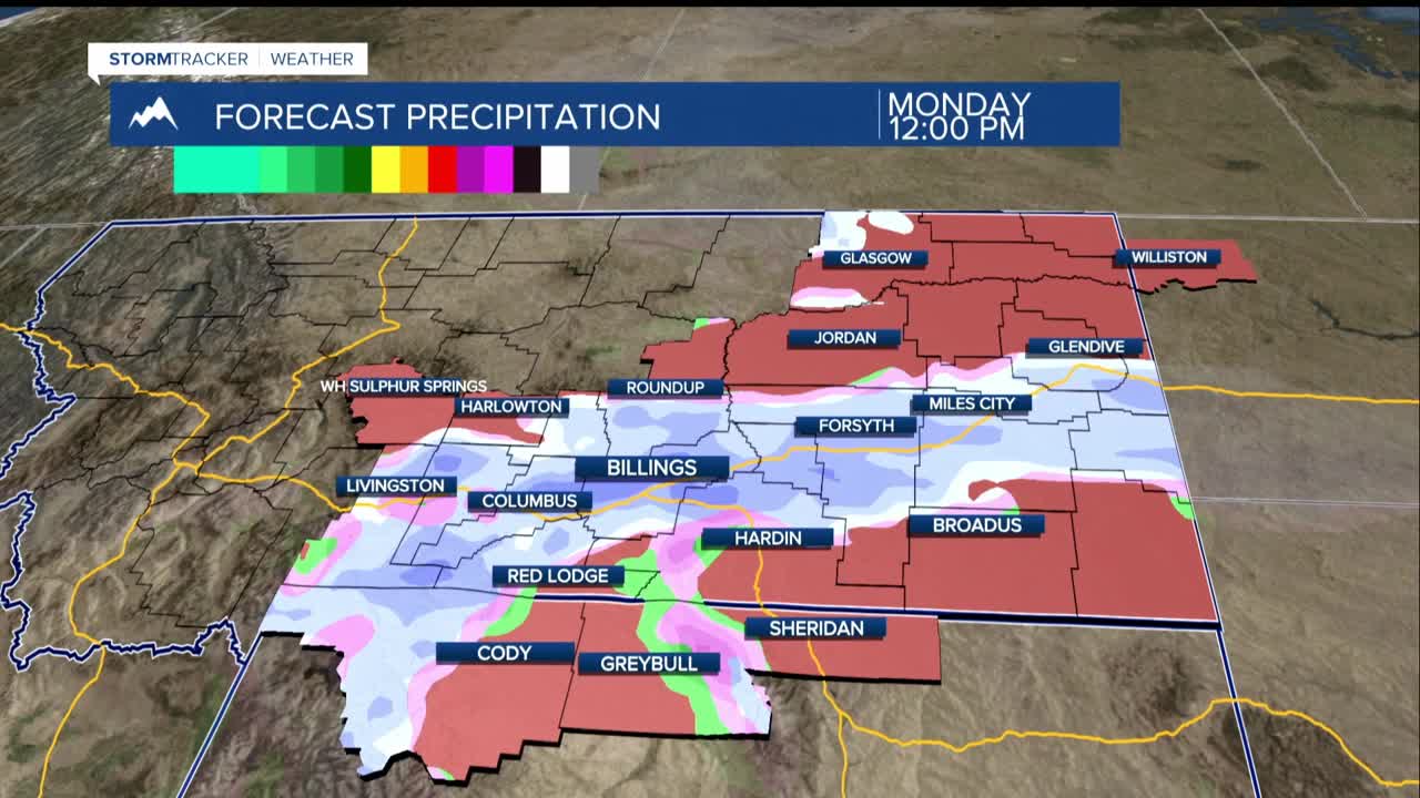
MONDAY THROUGH TUESDAY: An upper-level wave and surface cold front drop into the region Monday morning, and with it comes a hard reset. Rain and snow chances climb to 40–80%, with the best coverage west of Rosebud County (inlcuding Billings and Yellowstone County) and up in the mountains. Temperatures tumble into the 30s to 50s for highs.
Snow accumulation will be several inches expected for Red Lodge, the Sheridan foothills, and the mountain ranges. Lower elevations can expect light, mixed rain and snow accumulations. Northeast upslope winds will play a role in squeezing out precipitation totals in some areas, though the latest model trends have brought overall amounts down a bit from earlier forecasts.
Another surge of moisture tries to push in Tuesday, but it may end up staying south — mainly impacting the mountains and foothills or skirting the area altogether. Keep checking back as this one is still being ironed out.
WEDNESDAY THROUGH THURSDAY: Upper-level heights begin building Wednesday, giving temperatures a chance to rebound back toward the 60s by Thursday. Another round of powerful winds arrives Thursday across much of Montana.
END OF WEEK AND BEYOND: A more organized system is lurking for Friday into the weekend with cooler temperatures and widespread moisture. Details are still coming into focus, but the overall trend points to a wetter, cooler close to the week.
