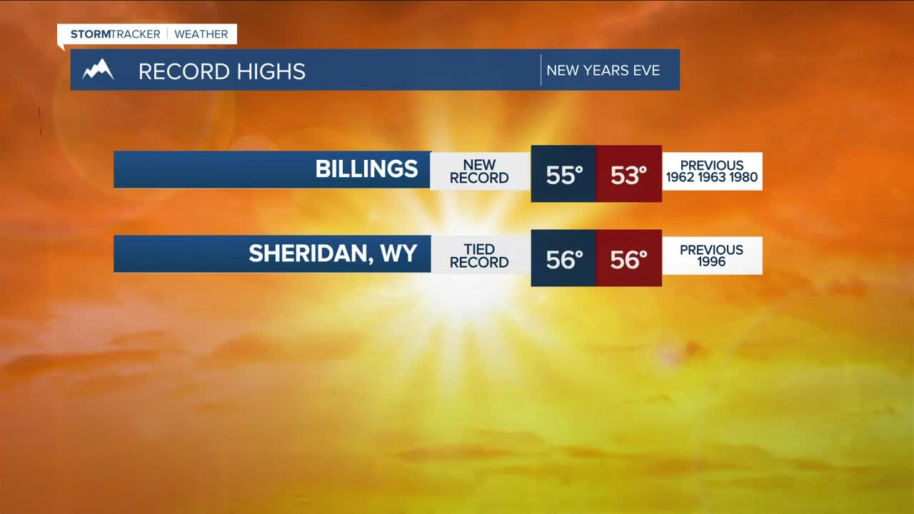


BILLINGS — Happy New Year!
Dry conditions stay in place on Thursday ahead of a surge of Pacific moisture moving in beginning Thursday night that will bring periods of light snow to the mountains—especially west-facing slopes—through the first half of next week, with only a few inches of accumulation expected.
Outside of a very slight chance of a rain shower Friday morning and then again Friday afternoon (less likely), Billings will remain in a dry pattern through the weekend as highs and lows stay warmer than average. An uptick in available moisture could bring a slightly better chance of rain early next week.
Periods of strong winds will continue to impact the western foothills through early next week, with gusts exceeding 50 mph from time to time. The rest of the area will be generally breezy, but gusts over 30 mph can’t be ruled out.
Temperatures stay warmer than average through at least the middle of next week, with highs in the 40s and 50s and lows in the 20s and 30s.
Miller Robson
Q2 Morning Meteorologist
miller.robson@ktvq.com
