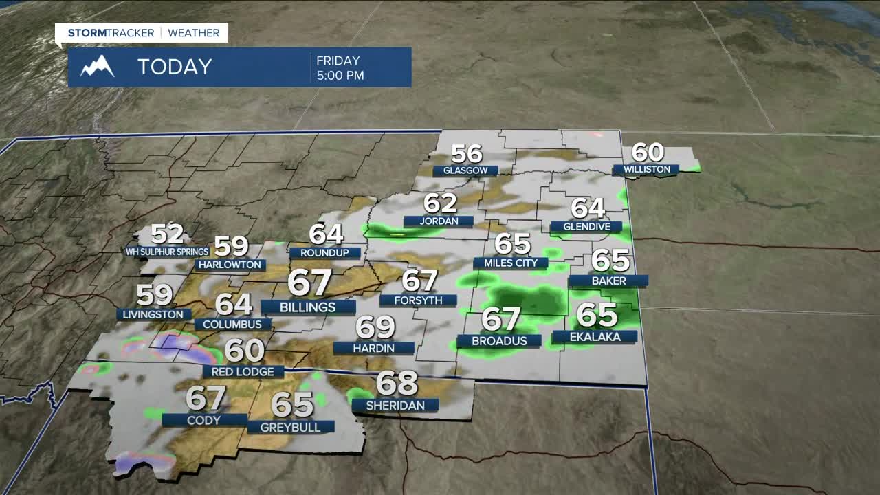


BILLINGS — A ridge is sliding east on Friday, allowing clouds to increase across the area. Downslope winds will still push temps well above normal, with highs in the mid-50s west to mid-60s east.
Mountain snow ramps up through the day above about 8,500 feet, with 4–8 inches possible on west-facing slopes before tapering this evening. Strong southwest winds along the Livingston I-90 corridor will peak early (55–65 mph through about 9 AM) before easing to 40–50 mph; westerly winds 35–45 mph will also develop with the front from Big Timber to Harlowton. Sheridan may see local gusts of 25–40 mph this morning. A weak jet and disturbance could spark some light evening showers southeast, with a few hundredths—possibly a tenth—in spots.
High pressure rebuilds Saturday with highs in the 50s and 60s, though lingering northwest flow may keep clouds or a stray sprinkle around the east. Clouds increase again Sunday, with isolated mountain rain/snow showers late as the next trough approaches. Highs cool into the 50s.
From Sunday night into Monday, a slow-moving upper trough crossing Nevada and Wyoming could pull moisture north and set up some upslope, bringing areas of rain and mountain snow. Tracks still vary, so confidence is low, but highs Monday look to run from near 40 to around 50 depending on how the system evolves.
Tuesday through Thursday look generally unsettled, with split flow across the West keeping periodic rain and snow showers in play and seasonal highs in the 40s to near 50°.
Miller Robson
Q2 Morning Meteorologist
miller.robson@ktvq.com
