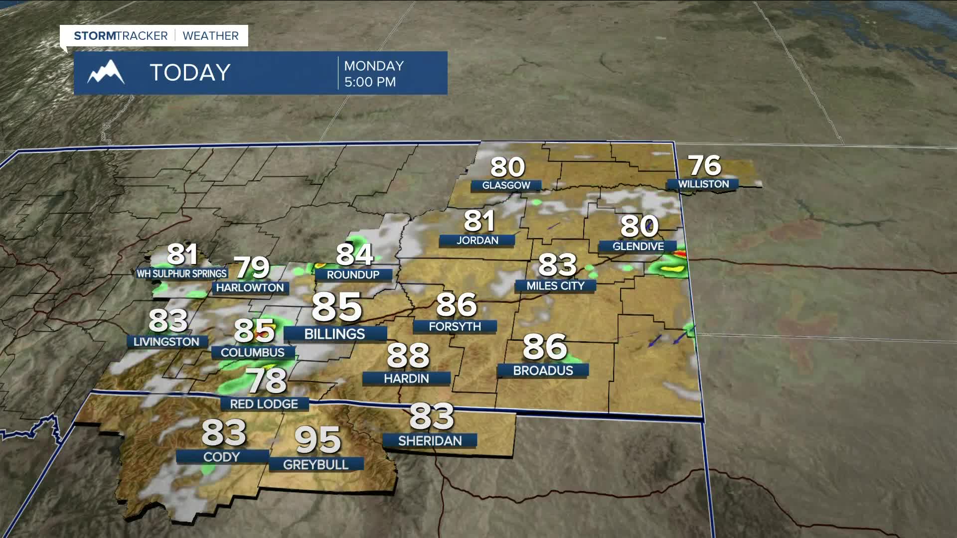


BILLINGS — Easterly flow will help push a healthy dose of moisture into the region on Monday. This, along with increasing potential instability, will bring a good chance of thunderstorms during the afternoon and evening across much of the area. Some storms could turn severe, with strong winds and large hail being the main threats. Periods of heavy rain will also be possible. Highs will be mainly in the low to mid-80s.
Persistent east-southeast flow will keep daily rain chances in the forecast for the rest of the week. Strong to severe storms will remain possible as well. By midweek, an uptick in atmospheric moisture will increase the chance of rain. Slow-moving storms could raise concerns for flooding in vulnerable areas.
Daytime temperatures are expected to stay below average through the weekend, with highs in the 70s and 80s—Tuesday and Wednesday being the coolest days. Temperatures will warm slightly by Friday.
Nighttime lows will range from the 50s to 60s throughout the week.
Miller Robson
Q2 Morning Meteorologist
miller.robson@ktvq.com
