


BILLINGS — An upper trough moving through our area Wednesday evening is causing isolated to scattered showers and thunderstorms, particularly in far southeast Montana and northeast Wyoming. These area in particular have the potential for strong storms with hail, strong winds, and heavy rain.
Drier air will move in overnight, potentially leading to fog development, especially in far southeast Montana.
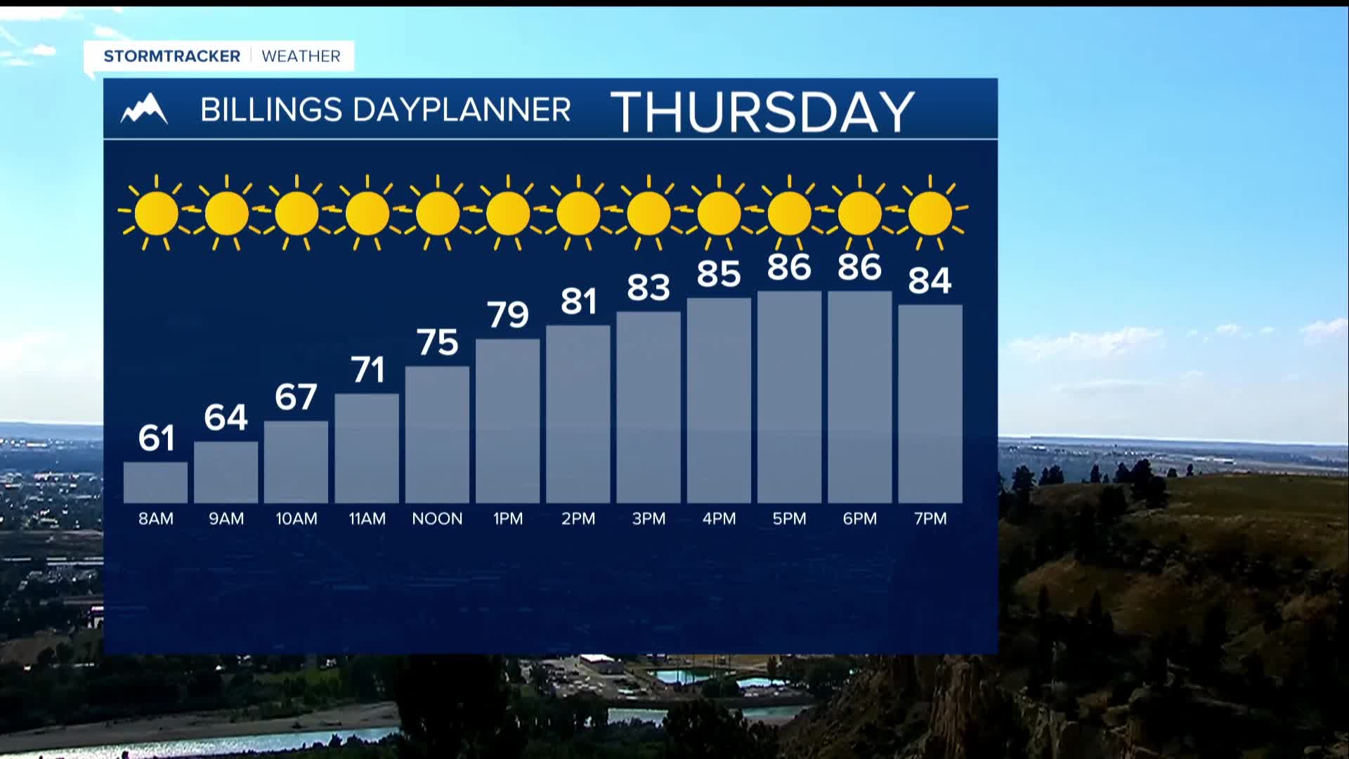
For Thursday, higher pressure will be building in, leading to mainly dry conditions with temperatures in the 80s.
There will be chances of showers and thunderstorms in the mountains and foothills, and a marginal risk for severe storms in far southeast Montana due to weak energy and moisture. Showers and thunderstorms will still be possible late Thursday into Thursday night due to an increasing low-level jet.
For Friday until Tuesday, southwesterly winds in the mid levels of the atmosphere will allow for daily chances of showers and thunderstorms. Drier conditions can be expected through Saturday, with moisture returning late Sunday, increasing the heavy rainfall potential, but storms don't look organized.
High temperatures will be in the 80s to mid-90s throughout this period. Overall, after a day of potential severe weather, the forecast indicates a generally warm and more unstable pattern moving into next week, with continued opportunities for rain and thunderstorms.
