


BILLING — A cold front is working its way through the area, bringing heavy snow to the mountains and rain, snow, or a mix to the lower elevations Monday.
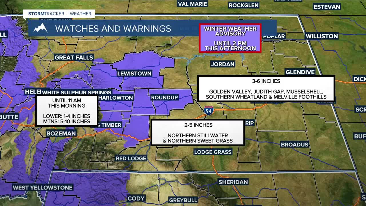
A Winter Storm Warning is in effect through 5 PM Monday. The Absarokas, Beartooths, and Crazies could receive up to 2 feet of snow, while adjacent foothills, including Red Lodge, could pick up 1–4 inches. The Bighorns could get between 3–6 inches, with a few spots reaching 6–8 inches. Areas west of Billings are under a Winter Weather Advisory and could receive 2–6 inches. Billings could pick up a few inches. Precipitation will move out by Monday night.
Dry conditions will prevail on Tuesday ahead of another disturbance that will bring a chance of more precipitation on Wednesday, although some models have the moisture sweeping across southern MT and northern WY.
Thursday and Friday should stay mostly dry, but rain and snow could return over the weekend. There is still some uncertainty with this.
The cold front will help usher in cooler temperatures to the region this week. Daytime highs will be in the mid-30s to low 40s on Monday, mainly 40s through Wednesday, before some locations, including Billings, reach into the lower 50s Thursday through the weekend.
Miller Robson
Q2 Morning Meteorologist
miller.robson@ktvq.com
