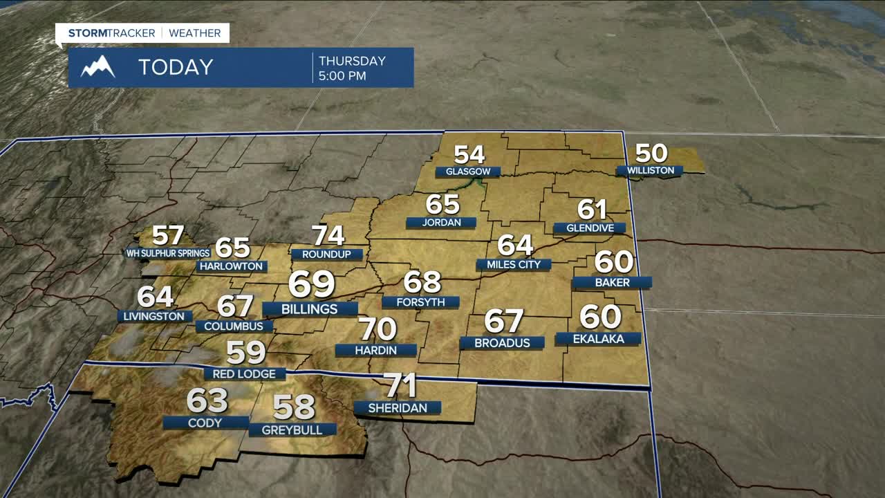


BILLINGS — Dominant high pressure and downslope flow will bring well above normal temperatures and dry conditions to the area on Thursday, with several locations (including Billings) vying for record warmth. Highs will be mainly in the 60s to low 70s.
Expect breezy to windy conditions on Thursday (gusts over 40 mph across the western foothills and 15–30 mph elsewhere). This, combined with low humidity, dry conditions, and warmer-than-average temperatures, will bring an elevated risk for grass fires through the weekend, especially in western and central zones of the Q2 viewing area. Don't cause a spark!
A weak backdoor cold front will drop through the area late Thursday afternoon, which could produce patchy fog into northeastern areas Thursday into Friday morning.
The front will also cool temperatures down a bit on Friday, with highs in the 50s to lower 60s, but still remain well above average.
High pressure keeps dry conditions locked in through the weekend, with daytime highs in the 50s to 60s.
Models are still suggesting a cooler and wetter pattern moving in starting Monday, with highs in the 30s and 40s by Tuesday, as a disturbance moves through. As of now, there is a decent chance for mountain snow early next week, with mainly rain in the lower elevations. However, if the temperatures turn colder than expected, the rain could transition to snow or at least a mix. Lots of uncertainty remains with this. Stay tuned.
Miller Robson
Q2 Morning Meteorologist
miller.robson@ktvq.com
