


BILLINGS — Tuesday night, a few chances for rain remain mainly along a cold front affecting the easternmost Montana counties. Little to no accumulation expected.
Expect a cooler day Wednesday, especially to the east of Billings. Our western areas feel only modest impacts from the cold front. A sharp temperature gradient is likely: highs in the 60s near the Dakotas to near 80s in Livingston. Smoke may move into the region, with potential air-quality reductions.
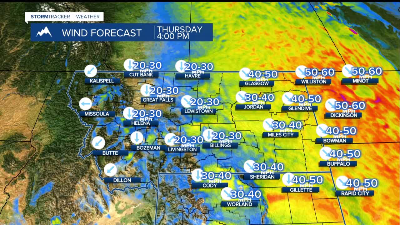
Thursday, a stronger cold front arrives, bringing strong winds and cooler air. Expect 40 mph-plus gusts from Rosebud County eastward, with surface gusts likely over 50 mph in northern Rosebud, Carter, and Sheridan County, Wyo., with 40 mph gusts common elsewhere. Highs Thursday will be mostly in the 70s to low 80s.
Friday morning, some locations could dip into the 30s. More smoke is possible, and air quality reductions could occur. Friday will feel much cooler with afternoon temperatures in the upper 60s to mid 70s with the coolest in the east.
Dry overall into the weekend with a chance of light or sporadic rain mainly in the western mountains Saturday and Sunday due to an upper disturbance under a stubborn ridge. Surface flow remains dry from the east-southeast.
Temperatures will trend warmer again over the weekend into next week but stay below normal Saturday, then gradually return to normal early next week.
Anticipate degraded air quality, so sensitive groups may want to limit outdoor activity on Thursday and Friday. Watch for gusty conditions Thursday, which could affect travel, outdoor activities, and fire weather plans in northern Rosebud, Carter, and nearby counties.
