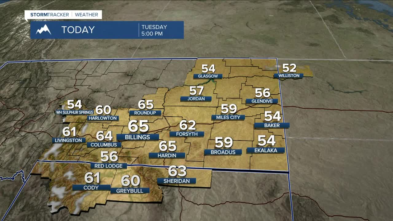


BILLINGS — It will be sunny and breezy (windy along the western foothills), and warmer than normal on Tuesday, with daytime highs running well above average for this time of year through Friday. Some locations could even flirt with record highs on Thursday.
A Pacific trough will bring a pattern change starting Friday night, with cooler temperatures and more unsettled weather for the weekend, including a chance of light lower-elevation rain and mountain snow Friday into Saturday morning. After a quiet and mostly dry Sunday, our next potential weather system looks to arrive on Monday, bringing additional rain and mountain snow to the area, though nothing major is expected from this system at this time.
Daytime highs will be in the upper 50s to mid-60s on Tuesday, upper 50s to low 60s on Wednesday, mid to upper 60s on Thursday, low to mid-60s on Friday, low to mid-50s through the weekend, then upper 40s to low 50s on Monday.
Nighttime lows will be in the low to mid-30s Tuesday night, mid-30s to low 40s Wednesday night, upper 30s to mid-40s Thursday night, then low to mid-30s through the weekend.
Miller Robson
Q2 Morning Meteorologist
miller.robson@ktvq.com
