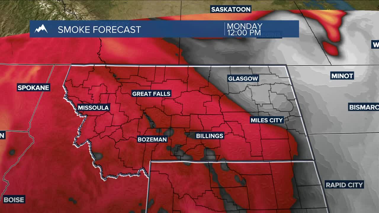


BILLINGS — Dry and warm weather will continue through Tuesday, accompanied by hazy skies. Daytime highs will be in the mid-80s to lower 90s. Wildfire smoke could be thick at times and may help keep temperatures a few degrees cooler than forecast. Nonetheless, it will be warmer than average.
A cold front is expected to move in late Tuesday, bringing cooler temperatures, breezy winds, and a few light showers to eastern Montana Tuesday night into Wednesday. Daytime highs will range from the low 80s west to the upper 60s east.
There will also be a slight chance of afternoon showers and thunderstorms over the western mountains on Friday, then across the rest of the area Saturday and Sunday.
An upper-level ridge shifting eastward will bring warmer temperatures on Thursday with highs in the upper 70s to mid-80s. A weak cold front dropping through late Thursday will cool highs down mainly into the 70s before temperatures warm again across the weekend with highs in the upper 70s to mid-80s by Sunday.
Miller Robson
Q2 Morning Meteorologist
miller.robson@ktvq.com
