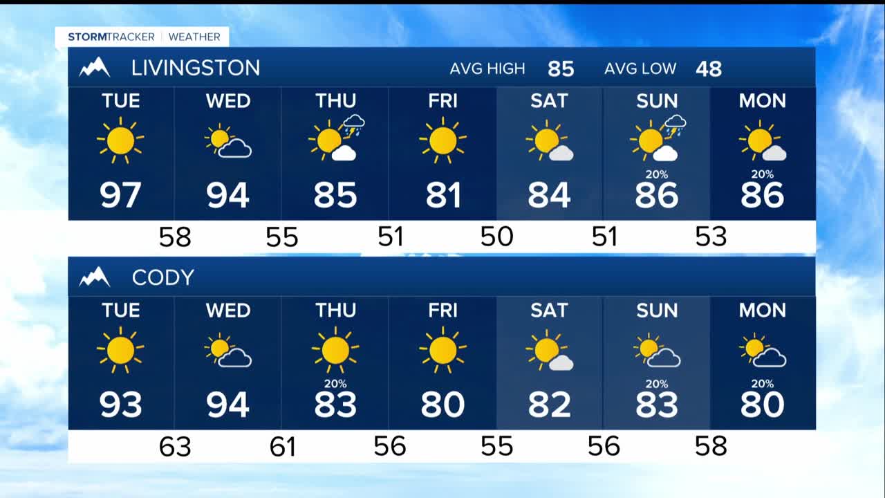


BILLINGS — A strong heat wave is expected in the region over the next few days, with temperatures reaching into the triple digits (for some on Tuesday and Wednesday.) Nighttime temperatures will remain warm, in the 60s to low 70s.
There are some isolated thunderstorms, especially in higher areas Monday evening. But the heat will limit storm activity on Tuesday and Wednesday. Any storms that form could produce strong wind gusts of 40 to 50 mph.
A cold front will arrive Wednesday night, bringing cooler temperatures and a slight chance of rain or thunderstorms that could create wind gusts. Smoke from local fires will be present but is not expected to reach levels that threaten health or visibility.
Due to the hot weather, Heat Advisories are issued for areas from Billings and Yellowstone County eastward to the North Dakota border. Anyone with outdoor activities should take precautions against heat-related health issues.
Fire danger is a concern on Wednesday due to heat, dryness, and existing fires. Although wind conditions may not be extremely severe, vigilance is necessary.
After the cold front passes, temperatures will drop to the 80s and stay around seasonal temperatures on Friday. Rain chances remain low.
The ridge of high pressure will rebuild over the weekend, leading to slightly rising temperatures, but they should stay below 90°F. Early next week, temperatures back up to around 90°, with very low chances for rain.
Overall, hot temperatures are dominant in the short term, with some cooling and low rain chances later in the week.
