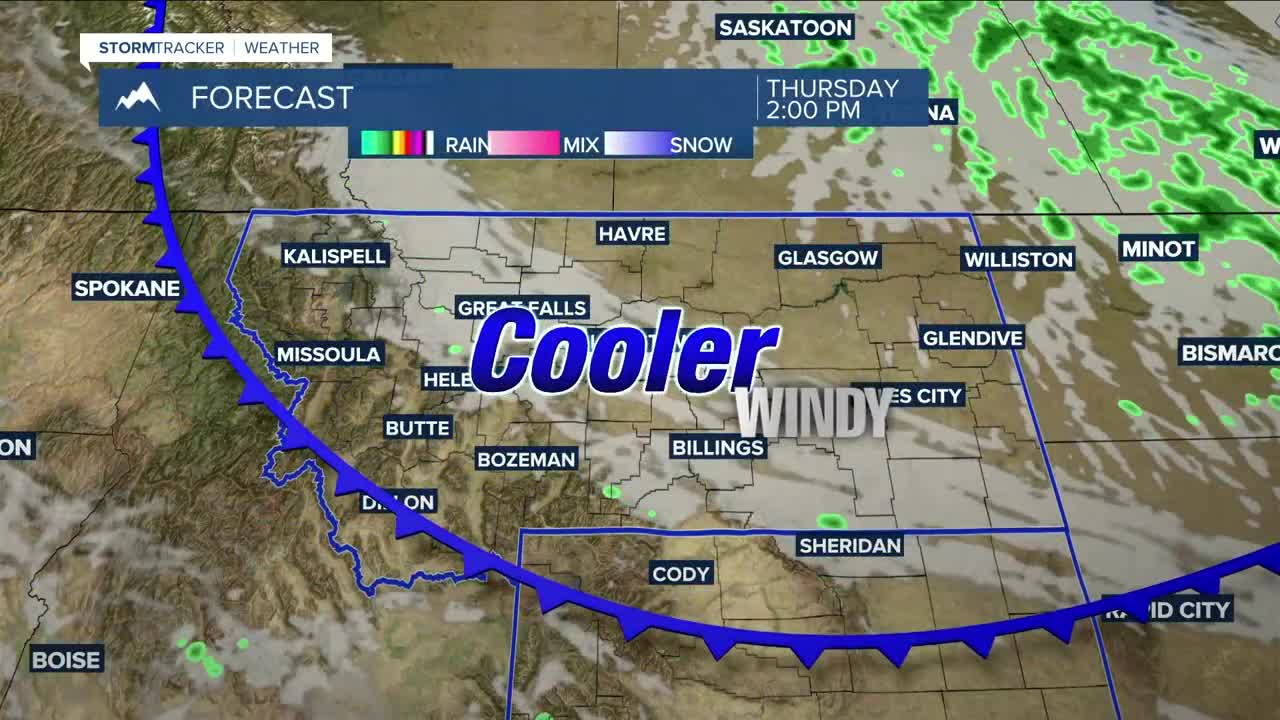


BILLINGS — A stronger cold front will sweep through the region on Thursday, bringing cooler temperatures with highs in the upper 60s to mid-70s, along with strong winds. Gusts between 30–50 mph are possible, with the strongest winds across the eastern plains. A few hit-or-miss showers could pop up. Canadian wildfire smoke will continue to be thick at times but will begin to lighten by the evening with the passing of the front.
Friday will be cool, sunny, and dry, with highs in the mid-60s to low 70s — a very pleasant day. Lows Friday night into Saturday morning could dip into the upper 30s in some locations, bringing the first frost of the season, especially in the eastern valleys. However, the chances for the first freeze are very low.
High pressure will bring mainly dry conditions over the weekend, but a weak upper-level disturbance could bring some rain to the area, with the best chances across the mountains and foothills. A thunderstorm or two could pop up.
Looking ahead to next week, there’s a slight chance for daily rain showers early in the week, then a better chance for thunderstorms mid-week.
Daytime highs will be in the low 70s to around 80° on Saturday, upper 70s to mid-80s on Sunday, mid to upper 80s on Monday, then upper 70s to low 80s through mid-week.
Outside of some 30s Thursday and Friday nights, lows will be mainly in the 40s and 50s through the middle of next week.
Miller Robson
Q2 Morning Meteorologist
miller.robson@ktvq.com
