


BILLINGS — It will be much cooler this week as we sit in the wake of a cold front. Expect daytime highs in the 30s to low 40s, with nighttime lows in the teens and 20s Tuesday through Friday.
A few snow showers and gusty winds will linger in our far eastern counties through Tuesday morning, but the rest of the area stays fairly quiet before northwest flow brings a chance for rain and snow Tuesday evening into Wednesday. Most lower elevations and foothills will see under a half-inch of snow, while the mountains pick up 4–8 inches.
A slight chance for rain and snow remains on Thanksgiving Day.
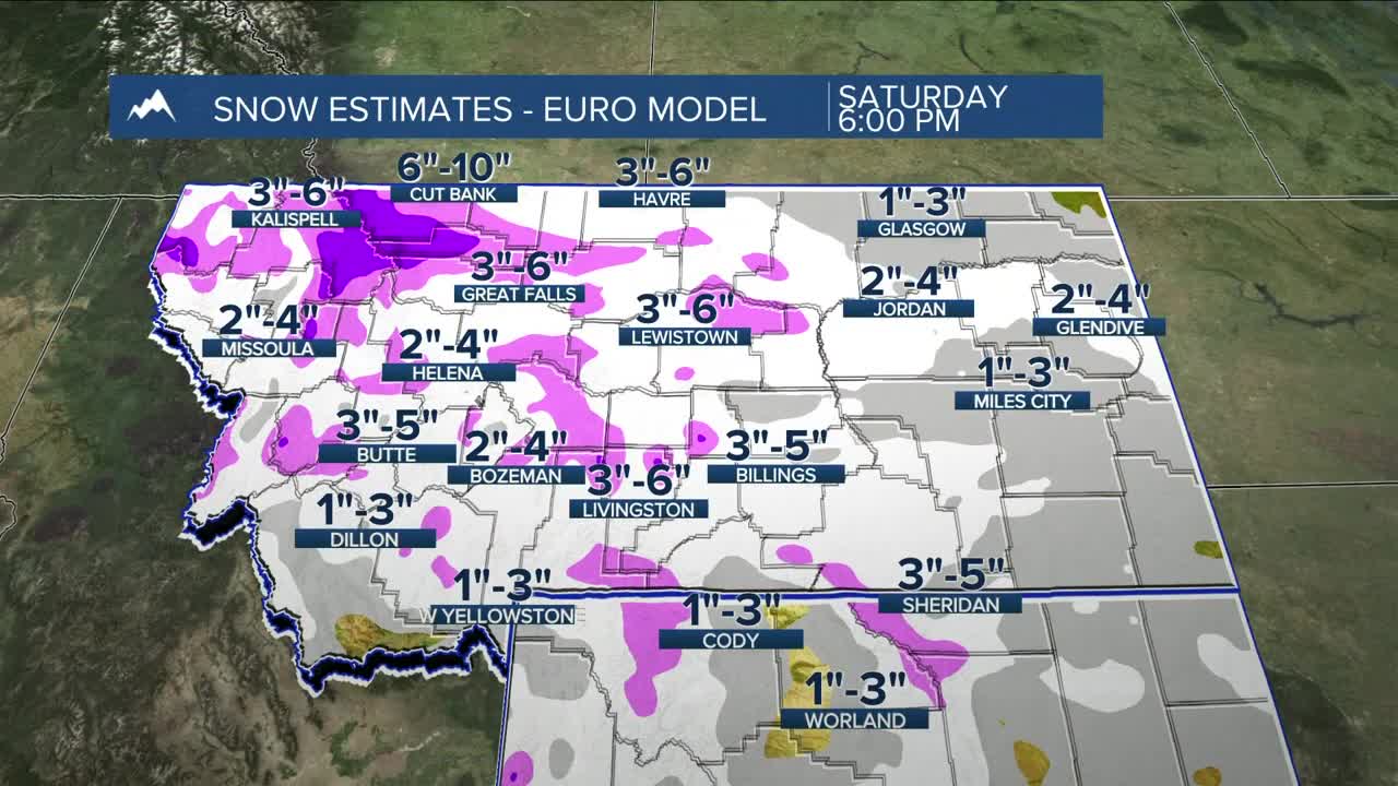
As for holiday travel, models are still trying to get a handle on what may become our first big winter system of the season — potentially impacting road conditions Friday through Sunday. A cold front is expected to move through on Friday, bringing more precipitation and a sharp cool-down, with a solid chance for 6+ inches of mountain and foothill snow from Thursday night through Saturday, while many lower elevation locations have a better than 40% chance of getting at least 4 inches. There is still uncertainty, so we'll need to see how the models line up in the next day or two. Prepare accordingly if you’ve got post-Thanksgiving travel plans.
Confidence is high that the coldest temperatures of the season arrive this weekend, with highs in the teens and 20s and lows dropping into the single digits. Some locations could dip below 0° Monday morning.
Miller Robson
Q2 Morning Meteorologist
miller.robson@ktvq.com
