


BILLINGS — Winds ramp up across the west on Monday out ahead of a cold front, with 55–65 mph gusts expected in Livingston, Big Timber, Nye, and Harlowton. Elsewhere, gusts of 20–30 mph will be common, although stronger gusts will be possible. Advisories may need to be issued.
The cold front moves through Tuesday morning, bringing a chance of light snow, mainly east and in north-facing upslope areas. For locations that do get snow, totals should range from a trace to 2 inches, with slightly higher amounts possible in the far east closer to the state line. Some blowing snow is possible, so watch for reduced visibility during the Tuesday afternoon and Wednesday morning commutes.
Another cold front will bring more gusty winds Tuesday night into Wednesday, especially near Sheridan and across the far east, with 50+ mph gusts possible in Baker, Ekalaka, and Sheridan. Winds ease Wednesday night into Thursday. This front looks to be on the dry side, but a few areas could see light snow on Wednesday.
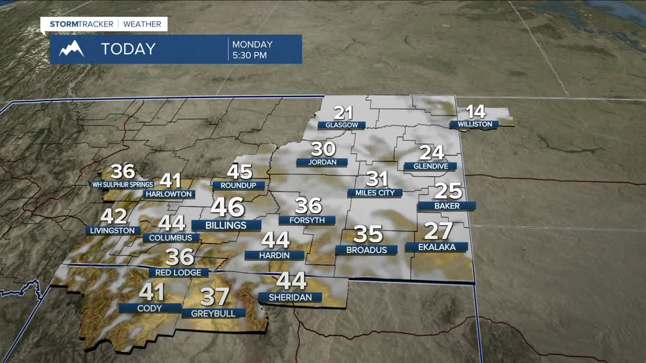
Daytime highs will range from the 20s east to 40s west on Monday and Tuesday, cooling to near normal Wednesday, then turning colder than normal Thursday and Friday with highs mainly in the teens and 20s. Our eastern counties could wake up to temperatures as low as -20°F Friday morning, and some western locations could dip just below zero. A few flurries are possible Friday through the weekend, but overall conditions look to stay dry.
Cold air may hang on into Saturday, but Pacific flow should bring a warming trend, with highs back into the 40s for some locations (including Billings) on Sunday.
Miller Robson
Q2 Morning Meteorologist
miller.robson@ktvq.com
