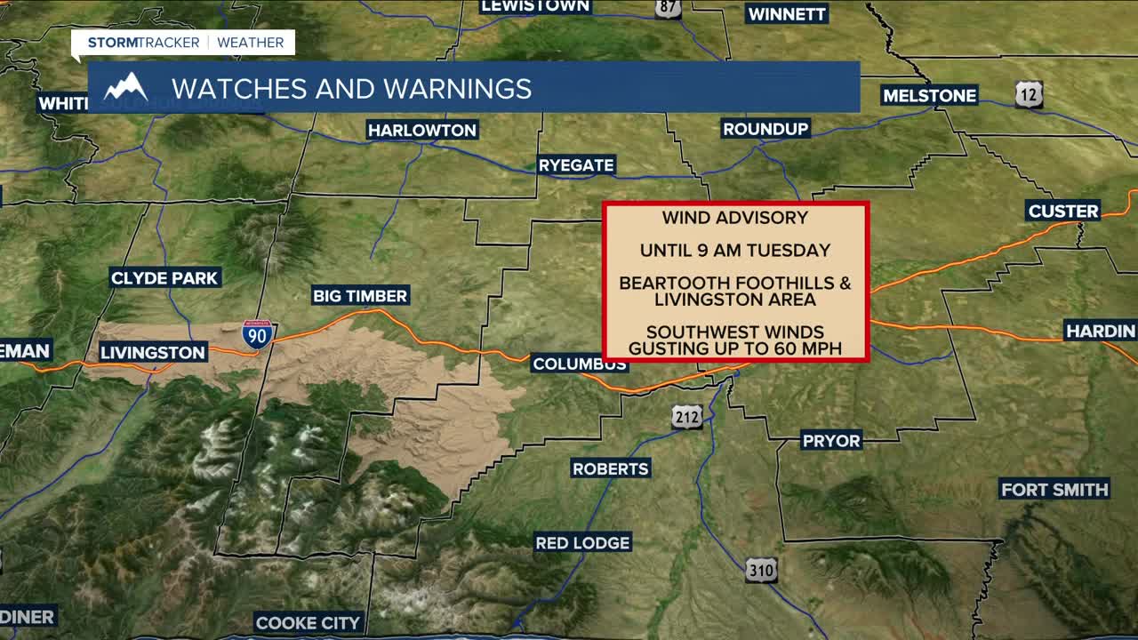


BILLINGS — The week starts off on a windy note, with gusts between 50–60 mph from the Livingston area to Nye through Tuesday morning, with a Wind Advisory in effect, while gusts between 40–50 mph will impact areas from Big Timber to Harlowton Monday afternoon through Tuesday afternoon. Gusts over 20 mph can be expected elsewhere through Tuesday afternoon.
High pressure will dominate the region through Thursday, keeping dry conditions in place. However, a fast-moving clipper system is expected to sweep through Tuesday and could bring light rain and western mountain snow, in addition to the aforementioned gusty winds.
Model confidence is high that a cold front will move into the area by the end of the workweek, bringing a chance of widespread wintry precipitation on Friday. High pressure is expected to bring dry conditions late Saturday through early Monday before another Pacific trough moves in, bringing a chance of more rain and snow.
Above-average temperatures are forecast for much of the week, with daytime highs in the low to mid-60s (a few areas may flirt with record warmth on Monday), upper 50s to mid-60s on Tuesday, mid-50s to low-60s on Wednesday, and low to mid-60s on Thursday. The cold front will bring highs down into the upper 40s to mid-50s on Friday, then mid-40s to around 50 degrees through the weekend.
Nighttime lows will be in the upper 30s to 40 degrees Monday night, upper 20s to mid-30s Tuesday night, low 30s east to upper 30s west on Wednesday and Thursday nights, and mid-20s to low-30s Friday night through the weekend.
Miller Robson
Q2 Morning Meteorologist
miller.robson@ktvq.com
