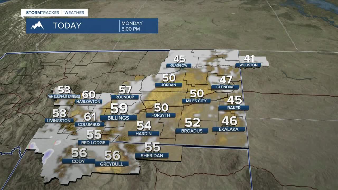


BILLINGS — Clouds increase from the south as isolated to scattered lower-elevation rain and mountain snow are possible across southern Montana and northern Wyoming on Monday as an upper low moves across Wyoming. Highs will be mainly in the 50s.
High pressure will bring mostly dry conditions on Tuesday, but a stray light shower can’t be ruled out in central areas.
Split flow brings another shot of lower-elevation showers and mountain snow on Wednesday—mainly for the higher terrain above Red Lodge.
The weather pattern will be fairly quiet Thursday through Sunday, but strong crosswinds will be possible along the Livingston and Big Timber corridor Friday night into Saturday and maybe Sunday.
Highs stay mainly in the upper 40s and 50s, with lows in the upper 20s and 30s this week.
Miller Robson
Q2 Morning Meteorologist
miller.robson@ktvq.com
