


BILLINGS — Happy Halloween!
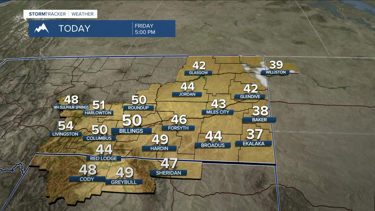
We'll enjoy lots of sunshine on Friday as daytime highs stay on the chilly side, with highs mainly in the mid‑40s to around 50°, although some locations in eastern to southeastern MT may not get out of the upper 30s.
It will be dry but quite chilly for trick‑or‑treating, with temperatures ranging from the mid‑30s in southeast MT to the 40s elsewhere. By 8 PM, they should drop to the 20s in southeast MT and the 30s across most of the rest of the area.
Gap‑flow winds will increase from Livingston to Nye on Saturday, with gusts between 30–50 mph, and the strongest winds expected west of Billings along the US‑191 corridor Saturday night into Sunday. An advisory may have to be issued. Much of the rest of the area will be breezy on Sunday, with gusts over 20 mph.
Although some cloudiness moves back in on Saturday, high pressure will keep conditions dry as daytime highs warm mainly into the low to mid‑60s. A cold front will pass through on Sunday, bringing minimal chances for lower‑elevation rain and mountain snow.
Confidence is high that the first half of next week will be dry, and temperatures will rise from around seasonal levels on Monday to warmer‑than‑average through the rest of the work week, with highs in the upper 50s to low 60s.
Some models are suggesting another disturbance moving in by the second half of the work week, bringing a chance of precipitation, but much uncertainty remains.
Nighttime lows will be in the mid‑20s to low 30s on Friday night, in the 30s and 40s Saturday night, then back into the 30s on Sunday night through early next week.
Miller Robson
Q2 Morning Meteorologist
miller.robson@ktvq.com
