


BILLINGS — After a cloudy start and even some rain in our western zones, the sunshine will break through to help keep daytime temperatures above average with highs mainly in the 60s and 70s across the area.
Winds will continue to be quite strong in southeastern Montana with gusts of 40 to 50 mph possible, especially in Carter and Fallon counties. With the windy and dry conditions to go along with the warmer-than-average temperatures, fire concerns will remain elevated today so don't do anything outside that will cause a spark.
Flow up from the south will stay in place today bringing a chance for showers and maybe even a thunderstorm or two across our western zones this afternoon before sliding across the rest of the area starting tonight as a deep upper low heads towards us out of the Great Basin.
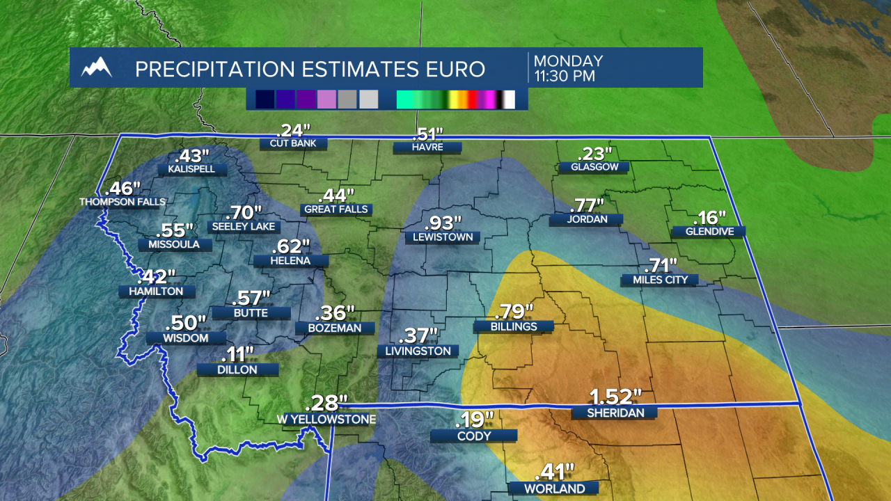
This low will have a good bit of moisture attached, including from the Gulf, bringing a very good chance for lower-elevation rain and mountain snow across the weekend into Monday. (See the graphic below for the latest moisture projections)
Dry conditions move in beginning Tuesday.
The rainfall will help cool daytime temperatures down into the 30s to 50s from west to east tomorrow before dipping down into the 40s on Sunday. High pressure will help push daytime highs into the 50s and the 60s by the middle of next week. Outlooks show this will kick off a warmer-than-average and drier period by the end of the week.
-Miller Robson
Q2 Morning Meteorologist
miller.robson@ktvq.com
