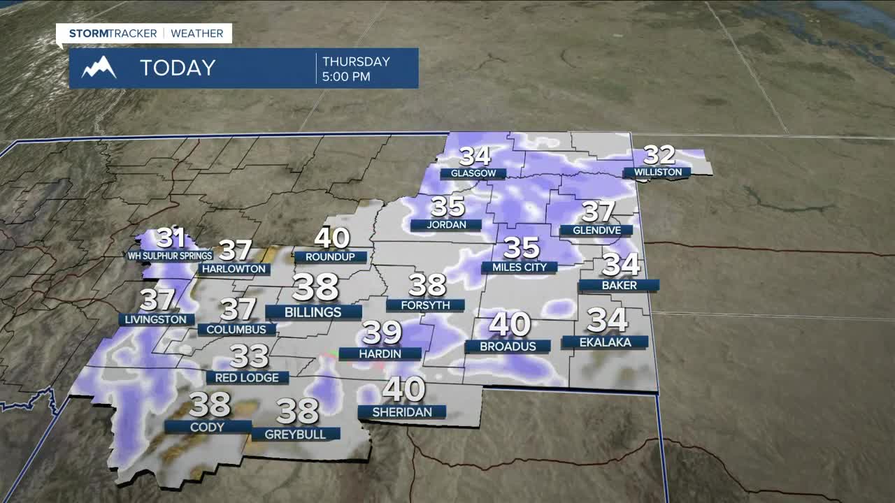


BILLINGS — It will be quite cloudy on Thursday with a chance of snow in the morning, especially east and south of Billings. Light rain and snow are expected in the afternoon before turning back to all snow during the evening. Outside of the mountains and higher hills, little to no accumulation is expected. Daytime highs will be mainly in the mid to upper 30s.
Crosswinds will remain strong across the western foothills on Thursday with gusts between 45–55 mph through noon in Livingston and Nye, while gusts of 40–50 mph will be possible in Harlowton and Big Timber through about 4 p.m.
A chance for rain and snow returns by Friday afternoon with highs in the upper 30s to low 40s. A cold front will drop in by late Friday, bringing a better shot of snow Friday night into Saturday, with 2–4 inches possible from Billings and areas east. These estimates will likely change, so stay tuned. Plan accordingly if you’ll be traveling during this period.
The mountains get the brunt: a long 72‑hour stretch of snow from Thursday through Sunday, with a foot or two possible on west and northwest slopes of the Beartooths, Absarokas, and Crazies. Keep this in mind if you plan to visit the backcountry. Warnings and Advisories will be in effect.
By Sunday, high pressure takes over, bringing mainly dry conditions, though some light snow is still possible.
Ready for a warm‑up? Downslope winds could help push daytime highs into the 50s by Tuesday as winds increase along the western foothills.
Miller Robson
Q2 Morning Meteorologist
miller.robson@ktvq.com
