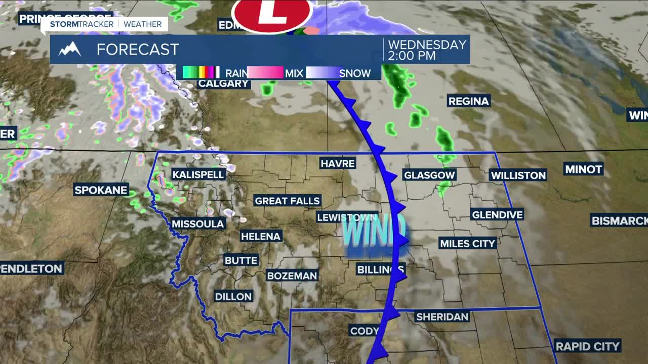


BILLIINGS — It will be cloudy but warmer on Wednesday, with highs in the mid to upper 50s and maybe a few 60s.
A mostly dry cold front is expected to sweep through late Wednesday, but a few isolated showers could pop up during the late afternoon into the evening.
The front will increase winds Wednesday into Thursday morning, with gusts out of the west-southwest between 20–50 mph across the area, highest west of Billings.
It will be cooler on Thursday and Friday (Halloween) behind the cold front, with highs in the mid-40s to low 50s. Conditions look dry at this time for trick-or-treating. Some locations in eastern Montana could dip below freezing by the time the kids venture out.
Another disturbance could bring strong winds, with northwest gusts up to 50 mph from Livingston to Nye on Saturday. Even stronger winds are possible on Sunday. As of now, there’s only a minimal chance of precipitation over the weekend, though some uncertainty remains. Stay tuned.
Miller Robson
Q2 Morning Meteorologist
miller.robson@ktvq.com
