

BILLINGS — Partly cloudy skies, dust in the air and warmer temperatures: That's the menu for the Billings area as another windy day takes hold.
At 2 p.m., it was 58 degrees in the Billings area with winds gusting to 52 mph. Around the rest of the state, you can see the high winds are 52 mile-per-hour in the Billings area, 54 mph over in Glendive.
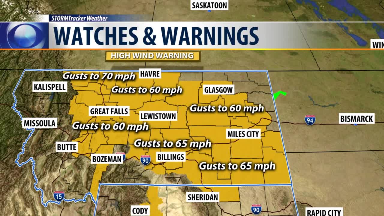
A lot of other places are seeing wind gusts into 30 and 40 mph range. We still have a High Wind Advisory for the Beartooth foothills until 11 p.m. Wednesday night for winds gusting to 65 mph.
And because of those high winds, we also have a Red Flag Warning for much of the Q2 viewing area, including Billings. That stays with us until 6 p.m. Wednesday night due to the high winds, high temperatures and low humidity.
This will cause erratic fire behavior, and if a fire gets going, it will burn out of control and hurry. Plus, we also have High Wind Warnings across much of eastern Montana for winds gusting anywhere from 60 to 70 mph Wednesday.
Caught up in all that is a pretty stiff jet stream and a lot of moisture moving into the state from the west. This showed showing up on the Doppler radar Wednesday.
Also caught up in the jet stream is a new cold front that's dropping down from Canada. It too is adding to the windy conditions. The cold front is forecast to move to the Wyoming state line about 6 p.m. Wednesday night.
As the front advances into Wyoming, it will eventually start taking all the wind. Sunny skies will return on Thursday morning. We will keep that sunshine across Montana, east of the Divide, throughout the day Thursday and much of Friday.
Our temperatures will continue to stay into the 50s Wednesday afternoon then roll back down to the 20s Thursday morning and get back up to 48 degrees about 1:30 p.m. Thursday.
We will top out at 53 degrees on Thursday, get up into the 60s on Friday and Saturday, then drop back down into the 40s for highs on Sunday and Monday, then get up to 51 degrees on Tuesday.
BILLINGS FORECAST
TONIGHT: Partly cloudy and windy this evening then turning cooler. Northwest winds 15 to 30 mph gusting to 50 mph and then relaxing overnight. Low 27 degrees.
THURSDAY: Mostly sunny and a little bit cooler with less wind. Southwest winds 10 to 20 mph high 53 degrees.
FRIDAY: Mostly sunny and warmer. Southwest winds 10 to 20 mph. High 66 degrees.
