

BILLINGS — Heavy rain will pop up here and there closer to the mountains Monday evening. Areas around Livingston (Park County) to Harlowton (Wheatland County) south to near Red Lodge (Carbon County) and Cody (Park County, Wyoming) could see pockets of heavy rain.
Locally heavy rain could cause some flash flooding. Gusty winds are likely around storms. Areas from Billings eastward will be drier.
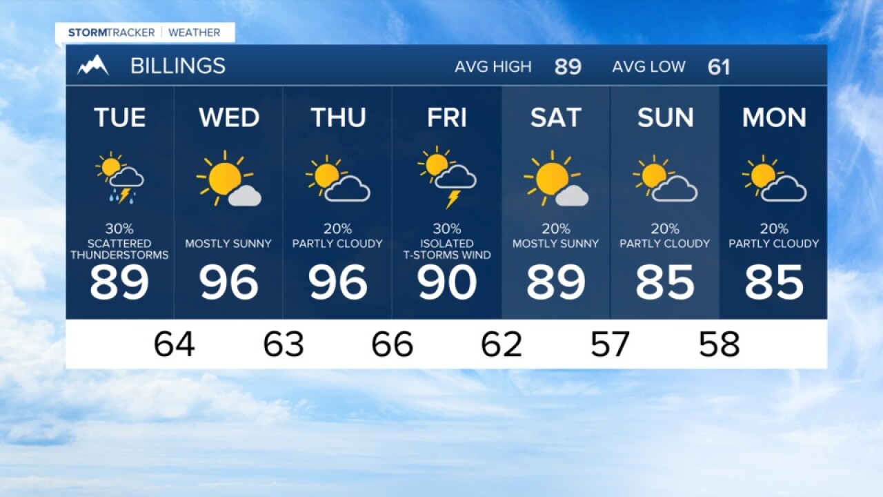
A combination of smoke and clouds will help to hold temperatures up in the 60s to around 70 for much of Southern Montana and Northern Wyoming early Tuesday, but hold back the afternoon highs to the mid-80s to mid-90s.
A few storms develop Tuesday afternoon and evening, but they may produce wind and lightning with little rain.
After midweek heat back into the 90s, the current trend is cooler by the weekend. With scattered showers and isolated thunderstorms, highs may stay in the mid-80s.
Billings forecast:
Monday night... Smoky haze and mostly cloudy. A low around 70.
Tuesday... A high near 89. Mostly cloudy with a chance of a shower or thunderstorm by the afternoon.
