

BILLINGS — TONIGHT: A slow-moving low pressure system continues its eastward drift, bringing scattered showers and isolated storms to eastern and northern Montana. As the day winds down, expect smoke and haze to drift in from western wildfires, particularly affecting foothill and mountain areas through Monday.
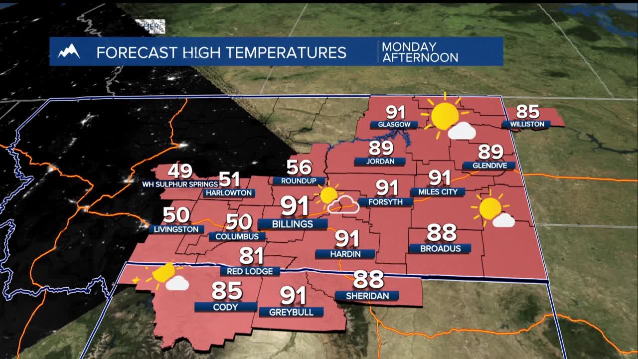
MONDAY: Monday morning brings patchy fog potential across the eastern third of our area - especially river valleys near Baker where earlier rainfall and lingering clouds create perfect fog conditions with light, variable winds. Expect continued dry conditions, save for a stray mountain shower. A building ridge will dominate, pushing temperatures 10-15 degrees above average by Monday.
TUESDAY: Tuesday evening marks a pattern change. A disturbance tracking from Alberta through northeast Montana into North Dakota will push a cold front through our region. While rain chances stay east of Billings, gusty northeast winds could reach into the foothills Tuesday night. This front also carries Canadian wildfire smoke toward eastern areas, including Miles City.
FIRE WEATHER CONCERNS: Multiple days of above-average temperatures raise fire danger concerns, though conditions aren't expected to reach critical levels. Daily minimum humidity will drop into the teens with 80-degree highs, but this 2-3 day dry spell should keep is fire weather aware.
WEDNESDAY-SUNDAY: An upper ridge parks west of us midweek while a strong low sits over the Great Lakes, placing us under northwest flow. This gradually shifts east, allowing high pressure to build over our region into the weekend.
Wednesday will be cooler behind Tuesday's front with mid-80s west of Bilings, and upper 60s to 70s in the east.
Thursday: Rebounding into the 80s.
Friday: Another weak front drops us a few degrees Weekend: Back to well into the 80s
Overnight lows will range from mid-40s to mid-50s throughout the period. Precipitation remains scarce with only slight shower chances over high country.
