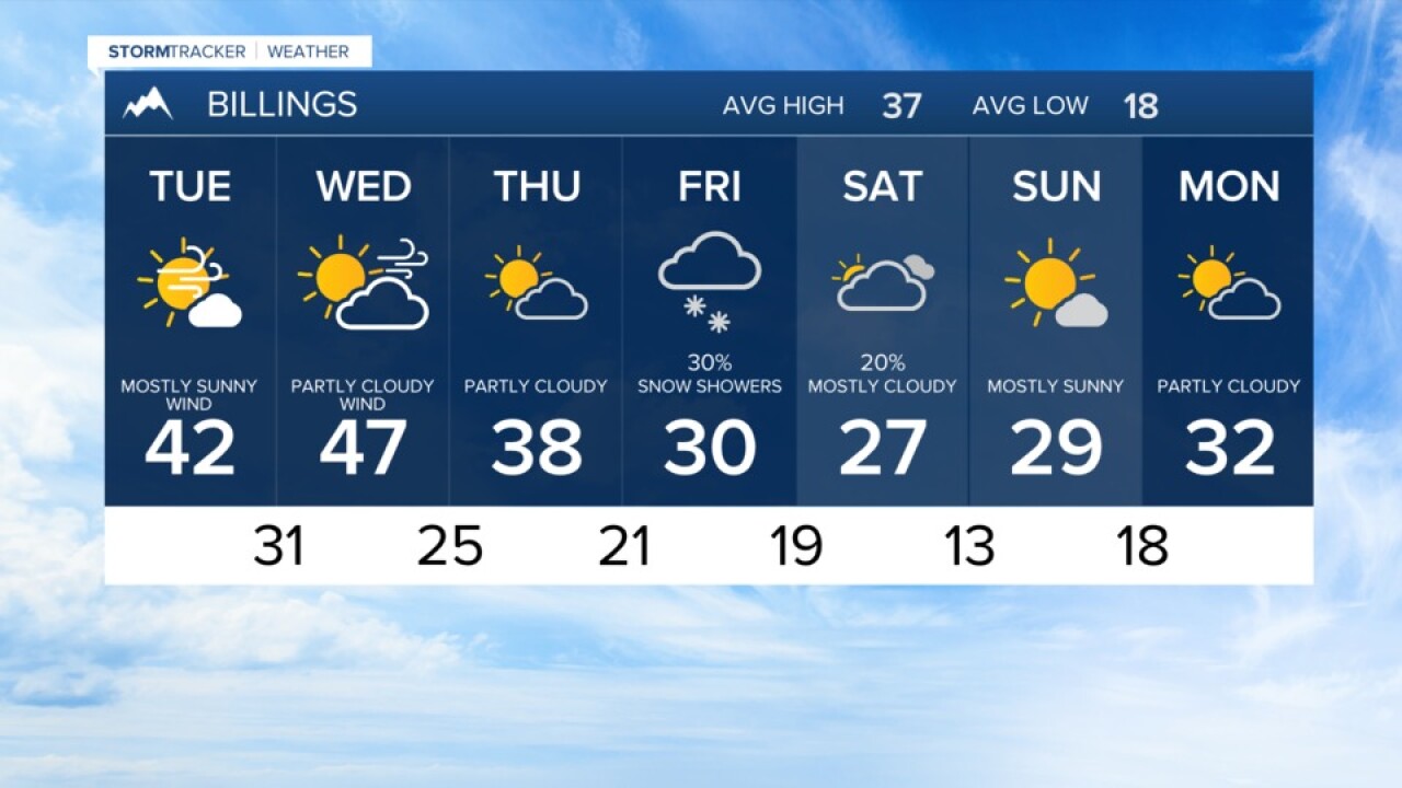


BILLINGS — We go from Monday showers to windy periods Tuesday and Wednesday followed by colder weather this weekend.
Scattered rain and snow showers on Monday brought reports of just a trace to up to 6 inches of new snow to southern Montana northern Wyoming. The higher totals were in the Bighorn Mountains.
For central Montana closer to Lewistown and Great Falls, a foot to a foot and a half of new snow was reported into the Little Belt Mountains.
As showers decrease Monday evening, temperatures will slip to the mid teens to mid 20s by early Tuesday. Expect some clearing through the evening with some clouds remaining in eastern Montana.
High temperatures Tuesday will be mainly in the mid 30s to mid 40s with a mix of clouds and sun. Winds will start to increase in the mountain foothills around Livingston/Big Timber/Nye/Harlowton.
By Tuesday evening, winds could be hitting gusts of 50 to 70 miles an hour in the mountain foothills pushing gusts of up to 40 miles an hour to around Billings. Periods of wind will continue through Wednesday.
For most of the area, temperatures peak on Wednesday with readings into the 40s for the lower elevations. With less wind Thursday, the temperatures begin to transition downward.
There still a lot of uncertainty in the forecast details closer to the weekend. But the overall trend is cooler with highs trending towards the 20s and lows in the teens in single digits with a chance of snow. Check back as details become clear.
Billings forecast:
Monday night… Showers ending and turning partly cloudy. A low of about 25.
Tuesday… Partly cloudy with winds increasing in the afternoon. Gusts could reach near 40 mph. A high near 42.
Wednesday… Partly cloudy with periods of gusty winds. A high close to 47.
