

BILLINGS — TONIGHT: Winds are picking up across the western foothills, particularly from Livingston to Nye. Those winds will intensify and spread into mountain areas and gap locations, with the US-191 corridor from Big Timber to Judith Gap also feeling the push. Red Lodge and Sheridan foothills could see mountain wave activity kick in after midnight. Gusts of 60+mph are possible west of Billings all night.
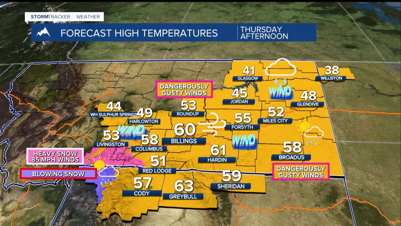
THURSDAY: By 6 a.m., High Wind Warnings will be in effect across the entire region. Expect the strongest gusts in the afternoon, with winds likely persisting until around 6 PM when the cold front moves through and winds shift to the northwest. Highs will be in the 50s to low 60s.
This could rival or exceed Sunday's wind event. Gusts of 60 to 70 mph are likely for most areas, with 80+ mph gusts possible in the mountains and foothill-prone spots like Livingston, Big Timber, and Harlowton. Localized reports of 80 to 90 mph peak gusts would not be surprising. High-profile vehicles should not be on the roads. Roofs, fences, and trees are all at risk, and power outages are possible. Despite recent light precipitation, dry grasses remain a fire hazard so avoid any activity that could create sparks.
THURSDAY NIGHT THROUGH THE WEEKEND: As the wind threat eases Thursday night, an abundant flow of moisture runs over a cold air mass and kicking off a prolonged and significant snowfall event that will persist well into the weekend.
The heaviest snow will focus across the mountains of central Montana, from the Belts and Snowies extending southeast, where a Winter Storm Warning is in effect around the Beartooths and a Winter Storm Watch for Yellowstone County (Billings) and the surrounding counties.
Expect feet of snow accumulating in the mountains. Lower elevations will also see more snowfall than initially expected, with confidence continuing to grow that Billings could see some significant accumulations. Areas like Livingston and the Red Lodge foothills remain a tougher call if cold air digs in deeper than models currently show, snowfall totals there could climb as well. Stay tuned for updates.
Temperatures this weekend will be noticeably colder, with highs in the 20s and 30s. Travel will be difficult, especially in the mountains and foothill zones.
