

BILLINGS — TONIGHT THROUGH TUESDAY: A persistent band of snow with big, heavy flakes already show 1 to 4 inches on the ground in some spots. Roads are looking snow-covered and slick north of Billings, so if you're traveling, expect hazardous conditions and give yourself extra time.
Overnight into Tuesday, a new jet stream impulse digs a bit farther south, increasing lift across mainly the southern half of the forecast area. Colder air pushes southward with upslope flow helping to boost snow totals for the Beartooth and Sheridan foothills. There's a 50 to 70 percent chance of picking up 2 or more inches in those areas, with a 30 to 40 percent chance of 4 or more inches through Tuesday evening.
A Winter Weather Advisory for the Bighorn Mountains and foothills goes into effect at midnight tonight. Most lower elevations will see lighter totals.
WEDNESDAY: Once the current system wraps up Tuesday night, the jet stream backs northward allowing cold air to retreat northward. Temperatures warm into the upper 40s to mid 50s, and westerly winds ramp up again, especially in the western foothills.
Areas like Livingston could see winds ramp up as early as Wednesday afternoon as surface pressures fall east of the Continental Divide. Wednesday night turns breezy to windy and noticeably warm west of Billings.
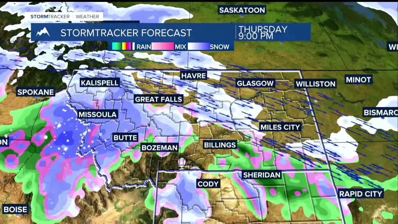
THURSDAY: Winds could rival and potentially exceed the gusts from this past Sunday. The winds in the atmosphere over the area will be 10 to 20 knots stronger than they were ahead of Sunday's event, as a 155-knot Pacific jet stream will be over the region. Wind gusts of 60 mph or higher are possible across the western foothills by early Thursday morning, depending on the timing and orientation of the jet.
If Sunday's 50 to 90 mph gusts impacted you, your property, or your plans, Thursday could hit harder, particularly from Billings westward. This is not a storm to take lightly.
This jet stream intrusion is connected to a true "atmospheric river"...a deep Pacific moisture tap with levels many times above normal. That moisture may be enough to keep widespread fire danger from reaching critical levels despite the powerful winds. Precipitation chances of 30 to 70 percent are in play for Thursday afternoon, even in the middle of the wind event.
FRIDAY THROUGH THE WEEKEND: The atmospheric river lingers through the weekend. The latest guidance shows 30 to 60 percent chances for an inch or more of precipitation through Sunday for Yellowstone (Billings) and the surrounding counties. Areas to the west with over 50 percent of locations are picking up at least a half inch.
Snowfall probabilities of 30 to 60 percent for 6 inches or more in the mountains through the weekend.
The wild card is temperature. The reasonable forecast range for Billings on Friday spans from 71 all the way down to 35, and Saturday is nearly as wide, ranging from 63 down to 28 degrees.
That enormous spread reflects the core uncertainty in the extended forecast with just a few hundred miles difference in where the jet stream sets up north to south will determine what your weekend looks like.
