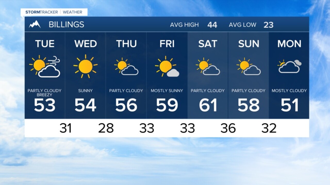


BILLINGS — With the turn of the calendar page comes a turn in our weather pattern.
The warm and dry conditions that started Monday will continue through the end of the week. Highs will gradually warm from the upper 40s and 50s to the upper 50s to 60s by Friday and Saturday.
The mountain foothills around Livingston and Big Timber will continue to be windy Monday night and Tuesday. Gusts of 40 to 55 miles an hour are likely with breezy conditions extending toward Billings.
Dry and warm conditions take over the weather through Saturday, which will likely be the warmest day overall.
A cold front by the end of the weekend will bring a downturn in the temperatures and an increasing chance of rain and snow showers by the middle of next week. Details on the cool down and showers are unclear so check back for updates.
Billings forecast:
Monday night… Mostly clear with a low of about 33. Westerly wind 15 to 25 miles an hour.
Tuesday… Mostly sunny with a high near 51. Still breezy at times 15 to 25 mph.
Wednesday and Thursday… Sunny to mostly sunny with a high in the mid-50s Wednesday and mid to upper 50s on Thursday. Overnight temperatures in the upper 20s to low 30s.
